Maps
Use these maps to plan your stay and explore the trails, sites, and surrounding area.
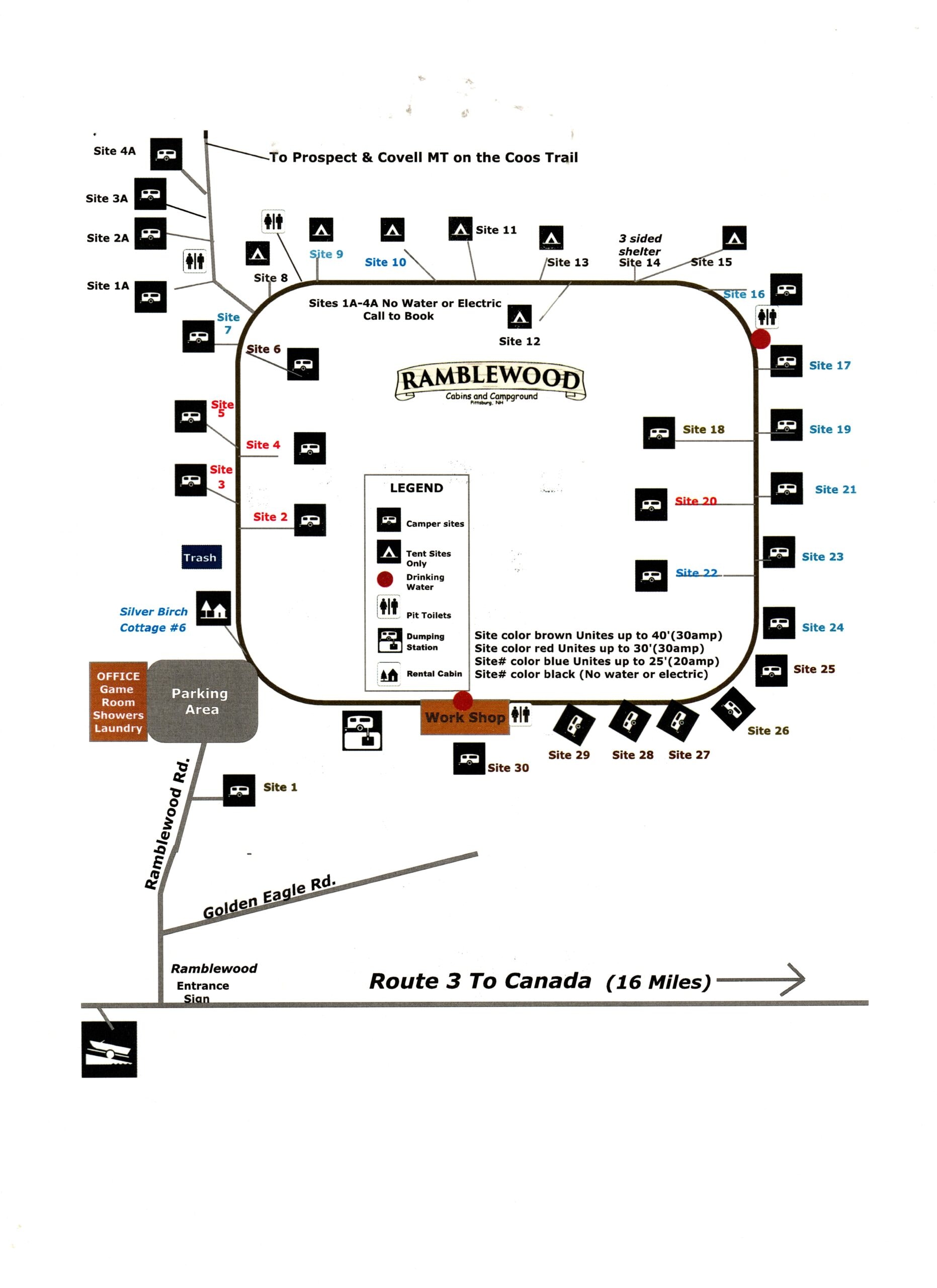
Campground Map
Full layout of Ramblewood Cabins & Campground showing all sites, facilities, parking, office, and road access from Route 3. Site colors indicate hookup type — brown (30 amp up to 40'), red (30 amp up to 30'), blue (20 amp up to 25'), black (no water or electric). Sites 1A–4A require a call to book.
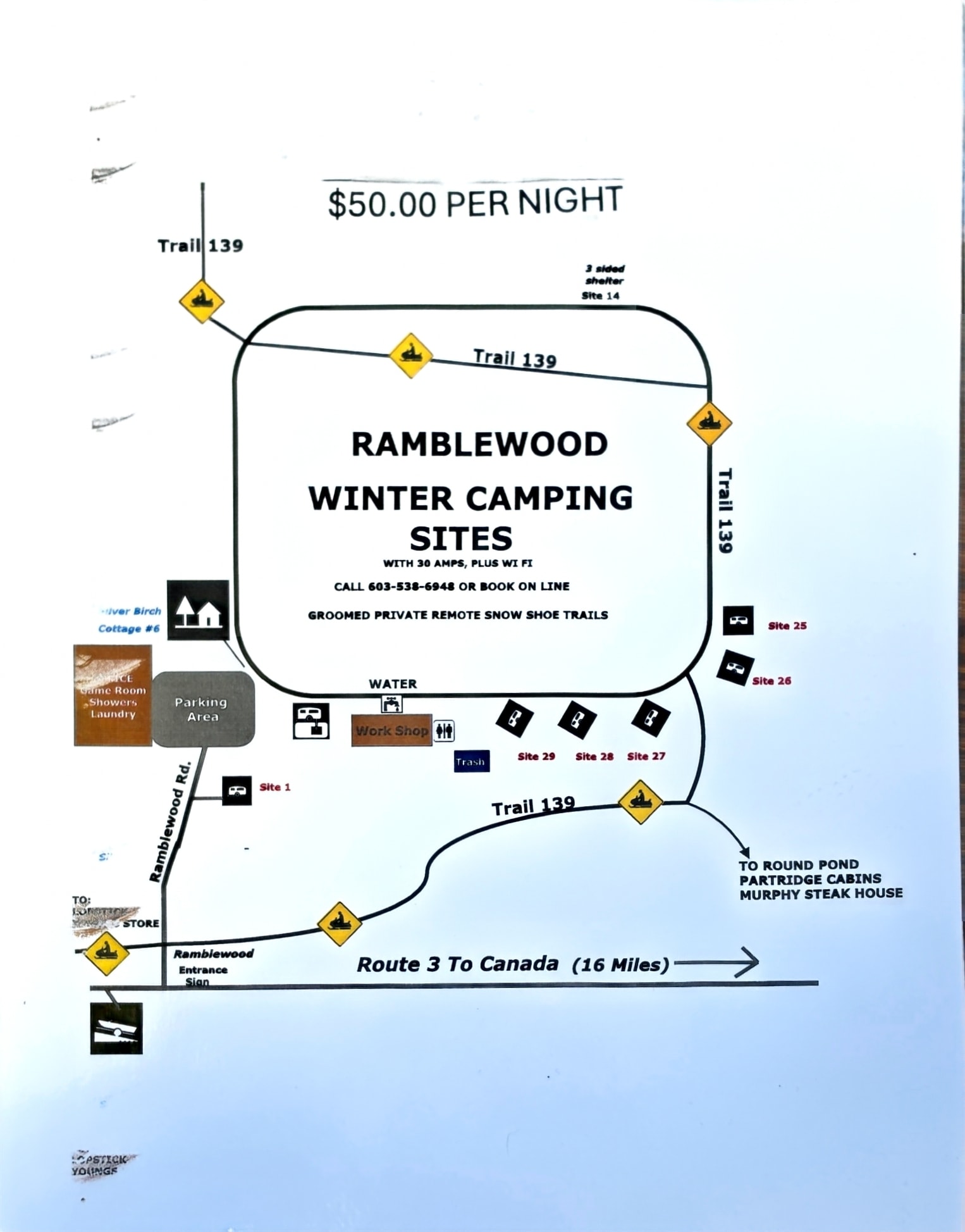
Winter Camping Sites
Ramblewood Winter Camping Sites — $50/night with 30 amps and WiFi. Groomed private remote snowshoe trails. Sites 1, 14, 25–29 available. Trail 139 runs directly through the property.
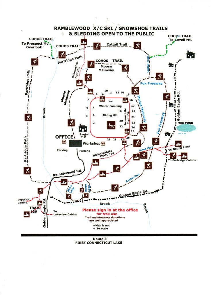
X/C Ski, Snowshoe & Sledding Trails
Ramblewood's groomed trail network — open to the public. Includes the Cohos Trail, Moose Mainway, Fox Freeway, Partridge Path, and more. Please sign in at the office for trail use. Trail maintenance donations are appreciated.